Multispectral Remote Sensing of Urban Green Spaces - A Case Study of Associated Neighborhoods in Boise, ID
Site Description - Boise, Idaho
The city of Boise is located in a semi-arid climatic zone in the western Snake River Plain region of west-central Idaho. On average, the city receives only eleven inches of precipitation annually (National Weather Service, 2023). The majority of the drinking and irrigation water feeding into Boise comes from trapped moisture and snow-melt from the mountains stored in a series of dams and canals on the Idaho and Snake Rivers.
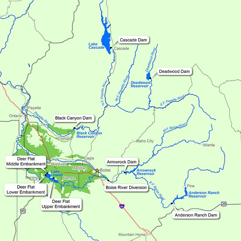
Map of major rivers and dams providing water to the western Snake River Plain (Bureau of Reclamation, 2020)
Recognizing both the scaricity of water but equal need for environmental and recreational greenspaces, the city of Boise, along with many partners, has been working since 2002 to develop environmentally conscious green spaces that meet the needs of the region's growing population, businesses, and native biodiversity. The city currently owns and manages 14 environmental reserves totaling nearly 5,000 acres and over 210 miles of trails (City of Boise, 2023). And while the abundance of parks and green spaces already developed in the city of Boise benefit the health and wellness of residents, businesses, and communities, it remains unclear how widely the principle of green spaces is adopted within Boise's associated neighborhoods.
Data Description - Neighborhood Boundaries
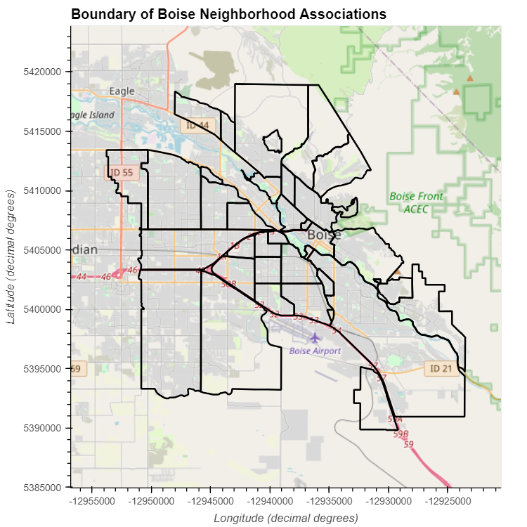
Polygons of the officially registered neighborhood associations in the city of Boise were used for this analysis. Neighborhood associations are non-profit organizations composed of land owners representing community areas with distinctly prescribed style or character as part of an official planning unit. The data was created by COMPASS, a regional planning agency for Ada and Canyon counties and is maintained by the City of Boise GIS team.
Citation:
City of Boise (2018) Neighborhood Associations. https://opendata.cityofboise.org/datasets/9751fb5ec88b47918ec3c0c866609f6d/explore?location=43.599418%2C-116.139637%2C11.42. Accessed 11/30/2023.
Data Description - NAIP Multispectral Data
The National Agriculture Imagery Program (NAIP) was piloted in 202. NAIP acquires and distributes digital orthophotography from across the United States. The aerial imagery is collected on a 5-year cycle during the annual agricultural growing season to best capture vegetation in its peak growth conditions. Imagery captures both natural color and near infrared at 2-meter, 1-meter, and 1/2-meter spectral resolutions. In the future, select locations will have 1/4-meter spectral resolution imagery available.
More information about the specifics of NAIP Imagery can be found in this information sheet from April 2023.
Citation:
USDA (2023). National Agriculture Imagery Program - 2021 Imagery for southern Idaho. https://naip-usdaonline.hub.arcgis.com/. Extracted using Earth Explorer API. Accessed December 2023. DOI: /10.5066/F7QN651G.
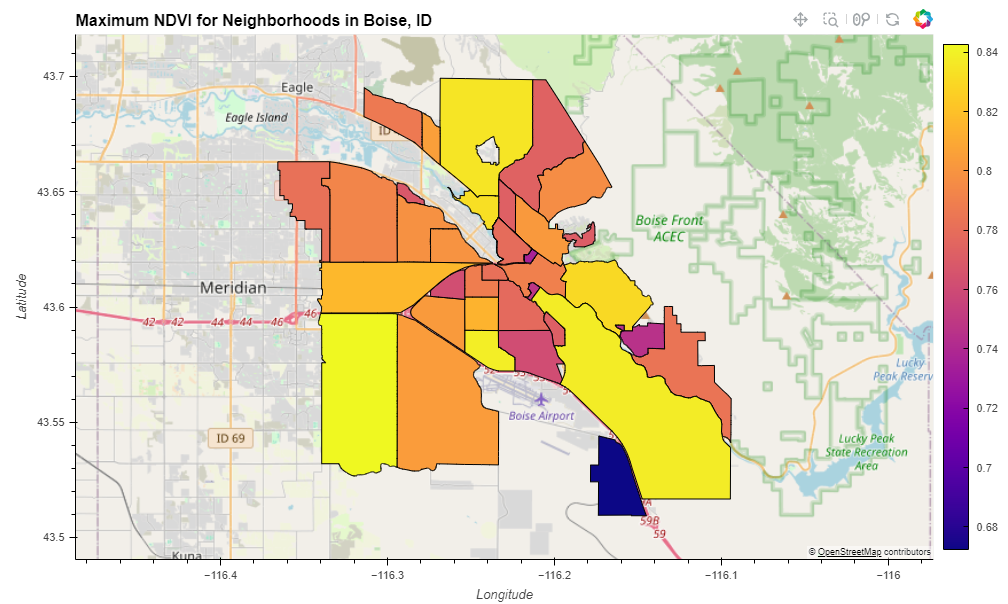
A chloropleth map of maximum NDVI for each of the Boise Neighborhood Associaitons reveal a wide range of vegetation indices across the city.
Maximum NDVI values reflect the peak growth vegetative indices within a given neighborhood for the year 2021. By this time, green space initiatives were well underway, especially along the Boise Greenbelt - a large, continuous swath of parks and pathways developed along the length of the Boise River. The Boise Greenbelt is well represented in the chloropleth map (long, northwest oriented neighborhood on the southeast corner of the study region), yielding high maximum NDVI values. Similarly high NDVI values are found in less populated neighborhoods on the margins of the cities where green reserves and large parks are located. The remainder of the more urban city neighborhoods though still yield moderate maximum NDVI values indicating that many neighborhoods are infact incorporating greenspaces into their communities, even where densely populated. There is one anomalous neighborhood on the southside of the city with relatively low maximum NDVI values. Imagery suggests that there is vast openspace in this neighborhood in addition to some large factories, so the reason for the low values remains unclear.